Thankful to be here
"No matter how powerful the illusion, you are never in charge"
Me
This is how it begins
1. You’re outside over a day away from another human. Ok,technically, you’re over 13,000 ft on the longest, most remote and highestcontinuous ridgeline in the lower 48…the White Mountains of CA/NV. You’re overtwice the height of the Grand Canyon above safety. But the mountain superlativesare almost irrelevant because…
2. You’re hit with an unforecasted extreme wind event with confirmed gusts over 100 mph. That’s equivalent to at least a category 2 but likely category 3 hurricane. Except…
3. Air temperature is about five degrees Farenheit. Much more detail of the storm and the damage it caused in the valleys will be discussed below. But for now…
Got any ideas? Great! Let me rule them all out for you:
Pitch a tent/bundle up/hunker down. All of these are not even worth considering. The wind was lifting me airborne and blowing me over (160lbs + 40lb pack). Pitching a tent would be extremely challenging in winds 1/3 this powerful. Even if a tent were already pitched it would be immediately shredded. So, no, you cannot make a shelter, no you cannot light a stove (to melt snow for water) and no you can’t even bundle up with those extra jackets in your pack. If you take your pack off and let go of it for any reason, you will likely watch it get blown into Nevada. It is too windy to access anything in your pack. And of course, wind chill is off the charts. If you stop moving for any reason you’re not gonna make it. Oh, and by the way, a storm is coming tomorrow at nightfall and is expected to drop five feet of snow. If you don’t have a plan to get completely back to civilization in the next 36 hours that’s it.
Get rescued. How? No human could reach you, and a helicopter…are you kidding? Heli rescues are not possible in winds even half this powerful.
Find the best way down. Great idea! There are noroutes off the ridge from where you are. It is too windy to read a map. Thewind creates a ground blizzard effect where windblown snow and ice make it notworth its while. I made several attempts to evaluate multiple routes down butwas unable to do so. There are 4 directions to travel:
Forward:This would be the best option over 95% of the time. But it’s over 21 miles ofridgeline to the car. Unless the wind dies down, you probably won’t make it morethan another couple hours on the ridge.
Backward/reversethe route: There is a technical, exposed section of ridgeline that preventsthis. This was extremely delicate rock climbing the day before and you’dunquestionably get blown off. Also, even if this were possible, this is for theprivilege of having to re-ascend the third highest peak in California, White MountainPeak, likely with significantly higher winds.
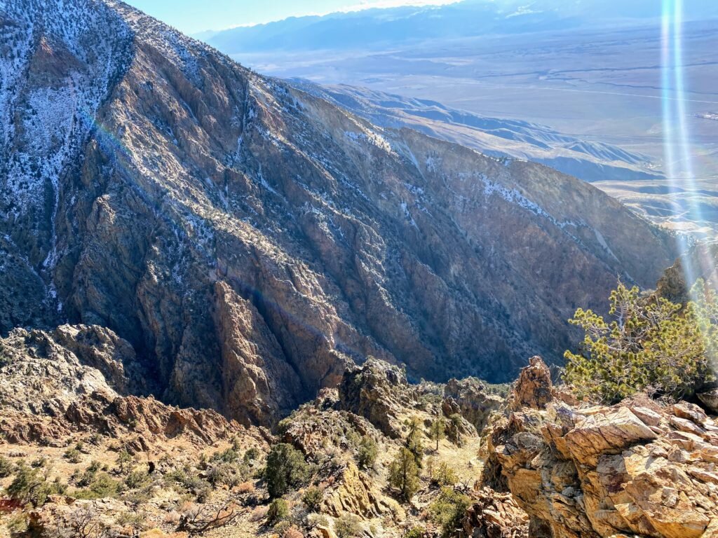
Bail east into Nevada: One look down this way and you realize it’s a horror show. Geologically, the Whites are bounded by a normal fault on the West, meaning that the east side is the “dip slope” which is less steep but muuuch longer. Plus, then you’re descending into Fish Lake Valley (coincidentally where I did much of my PhD work). It’s extremely remote, without infrastructure or resources outside of the tiny outpost of Dyer, NV.
Bail west into California: First of all, its hard to even glance into the wind. So it’s hard to tell, but you’re next to the start of a ridge that is very easy at the top but it’s quite obvious that it would be a horror show. No one in their right mind would do this. On the upside, there are lots of resources, communications, search and rescue in CA.
Your move.
The vision
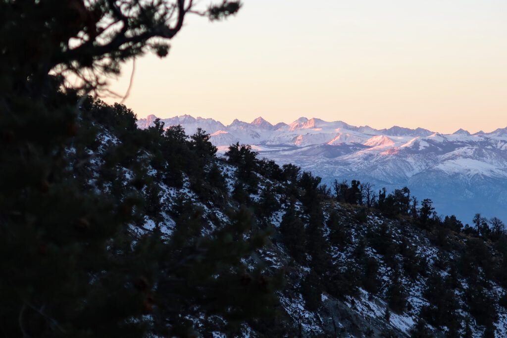
Traversing the White Mountains is one of the most unique adventures one can find. Their remoteness, the starkness of the tundra landscape and the beauty of the Sierra and other adjacent ranges make this trip an experience to remember. Add the ancient Bristlecone Pines, the oldest living things on Earth at over 4000 years, and you truly gain an appreciation for our relationship with the natural world. But you'll have to earn it. Traverses are done only by several parties each summer, and teams often take up to five days. The trip is seldom done in the other seasons. I'm only aware of two wintertime traverses, the first being done by Eastern Sierra legends Jay Jensen, George Miller, Galen Rowell and Dave Sharp on a National Geographic sponsored expedition in February 1974. Unlike my trip, this adventure was in the heart of winter and traversed the entire range and done on skis. The team took 16 days and encountered serious storms, including one with 100+ mph winds that trapped them for five days. Ironically, National Geographic decided not to run the article because of "lack of life-threatening circumstances!"
"For me, seeing the stark beauty and remoteness of the range in winter, with constant views of the snowy Sierra as if from an aircraft, rivals any mountain experience I've had in the greater ranges of the world"
Galen Rowell
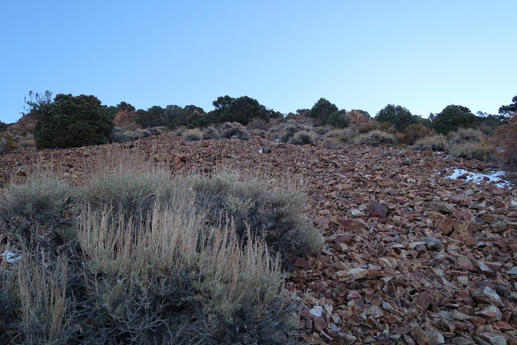
I've dreamt of the White Mountains traverse for about a decade and only this fall did I start to think it could work. Not only did I need the requisite fitness, logistical planning and motivation, but I needed to get lucky with the conditions. For one, there needed to be just enough snow to melt for water (as there's no water on the ridge) but not so much that it slows travel. I needed to be able to hike efficiently or it wasn't supposed to work. This is why the best time for the traverse is probably at the very end of the spring when there are just a few remaining snowdrifts as a water source but otherwise summer conditions.
Over the last few months, I'd been meticulously planning the trip. All of the logistics, mapping the route in great detail, finding all available trip reports and mining them for any usable data, downloading and analyzing historical weather data, checking webcams and checking about five different weather reports daily in the weeks leading up to the trip.
This fall set up well for weather. It was a peculiarly warm and dry fall. At first, I was excited, but then almost a little worried that not a single storm would blanket the range. But just before my window over Thanksgiving break, a small storm dropped the exact right amount of snow! Not only that, but the weather reports improved for my proposed dates. Now, a window of decent weather preceded a well-defined storm that would mark the true start of winter. This was it...the only window since spring that the White Mountain Traverse would be ready.
Backcountry bliss
After class on Friday, I drove out to Reno. The next morning, I drove to Queen Mine road on the north side of the range just north of Boundary Peak (13,147 ft), the highest point in Nevada. There, I met Paul Fretheim, owner of East Side Sierra Shuttle, who helped my car shuttle between the my car which we left at 9,200 ft and my trailhead at the base of White Mountain Peak (14,252 ft), the third highest peak in California.

I got started in early afternoon on Saturday the 23rd, and after a few hours of easy warm hiking, I reached Black Eagle Camp. These beautiful, free and well-maintained cabins are located at the old Champion Sparkplug mine, a mine operational in the 1920s-1940s for andalusite, used to make the heat-resistant ceramics in sparkplugs. It's a really splendid place, with all kinds of cool stuff from the mining days, a museum and of course the cabins.

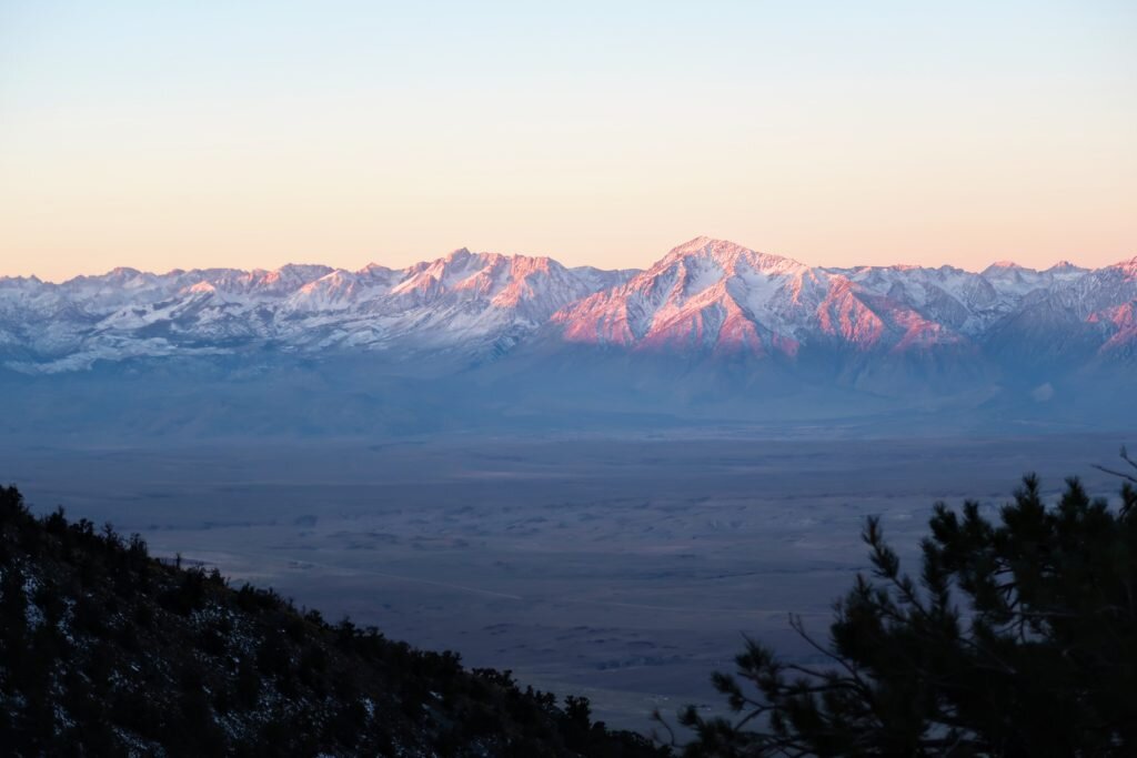
The next morning, I got a pre-dawn start and caught the morning alpenglow on the entire High Sierra. It was a sight to behold. While most of the east ridge, one of the longest routes in the nation at 9,500 ft of vertical, is poor climbing, the setting makes it a truly special place. Part way up, I had an incredibly close, long and intimate encounter with a baby bighorn sheep and then her mother. It was a spiritual moment as we all acknowledged each other. Not only that but their tracks showed me the way up the ridge. And later in the trip, it was perhaps the bighorn tracks that helped me stay alive.

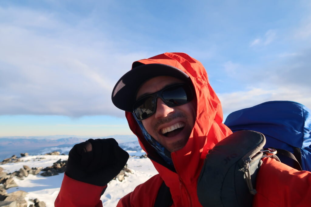
After about nine hours of climbing, I found myself alone on the summit.
-
-
Even worse than it looks. The east ridge has at least a few thousand feet of "one step forward, two steps back" -

-

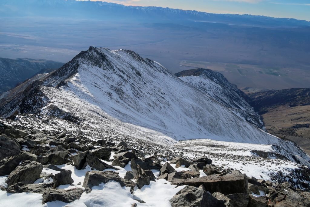
The first half of the traverse, with the Pellisier Flats in the distance -

The view south to Mount Barcroft -

The last few thousand feet of the ridge -
-

Thank goodness for the bighorn tracks! -
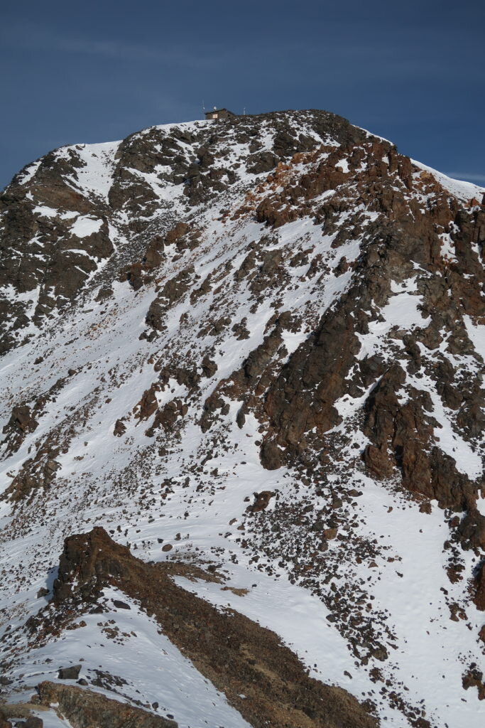
The summit research hut is finally visible -

The High Sierra and Owens Valley -
The east ridge route. Yes the whole thing. Yes, from the bottom. -
As it was late afternoon, I made an effort to press on and get as much of the traverse done as possible. At the very least, I wanted to cross the first technical section in the daylight so I could find a nice place to camp. The weather was blustery, but what else would you expect on such a high summit?

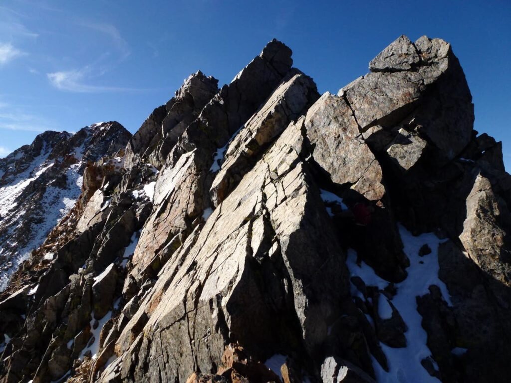
I ended up not quite making it across the tricky section by nightfall, requiring that I downclimb the crux moves by headlamp. The photos below, courtesy of Summitpost.org user Daria show this section. So add in that this was at night and partially covered in snow. While well within my abilities during good conditions, it was this section of delicate rock climbing that prevented my retreat during the wind event.

The storm
Things started to pick up just as I was looking for a tent site. I finally settled on chopping a nice little platform adjacent to a col because it was somewhat protected behind some rocks. As it was a bit windy, I focused quite hard on doing everything right in my tent setup so as not to lose my tent or a pole. After guying out the tent quite well, I settled inside, melted enough snow for a liter and a half of water, had a nice dinner and settled in for the evening. A few hours into the night, things began to worsen. The tent was now hitting me in the face. What a nuisance I thought! But by the time my alarm went off for the morning, half the tent was compressed by a newly-formed snow drift. I knew I needed to keep moving to get off the ridge before the snowstorm, so even though conventional wisdom would be to hang tight in the tent, I knew I at least needed to make some progress. I packed up and quickly got moving.
Initially, I thought, wow, this is really bad weather. What I didn't realize, is that unbeknownst to me, the storm was rapidly intensifying, leading the National Weather Service to issue a wind advisory, specifically citing my region as the worst of it:

What ensued was a truly legendary storm, ultimately becoming a "bomb cyclone" (one that rapidly intensifies). The storm set all time records for low pressure of a US West Coast storm, and I had direct line-of-sight across the Pacific to Asia.
Some facts about the wind event relayed to me afterwards by the Mono County Sheriff and Search and Rescue Coordinator:
Near Mono Lake, power poles were downed. Not the lines, the wooden poles snapped. I was approximately 7,000 ft higher in elevation on a ridge.
At Mammoth Lakes Airport, a gust of 94 mph was recorded. Rocks were picked up by the wind, destroying all of the cars parked there.
The strongest wind gust recorded was at Crowley Lake, 7,000 ft below and 25 miles due west of me:

Highway 6, 10,000 ft below me was closed due to wind.
Back up on the mountain, the winds dramatically intensified when I was required to traverse saddles and flats. In addition, I believe the storm intensified. I started to get spun around when the wind caught my pack. I would lean 45 degrees into the wind, plant both trekking poles and do as hard of a lateral lunge as I could, then get blown airborne and tossed onto the tundra. At one point, I hid behind a small rock and attempted to glance at my map but was unable. It was a ground blizzard, where airborne snow and ice not only pelted exposed skin but also reduced visibility. About two hours after leaving my tent, I was in the scenario outlined at the beginning. So, what did I do? I bailed down the ridge into California. I could barely see due to the wind, but from what I could gather, it was absolutely sickening. Something I would never choose to do in a million years.
But I was past choices. From this moment on, I was on the ride.
As it was directly into the wind, I resorted to huddling during the gusts, then running full strength as low as I could before hitting the ground. Like the football sled push drill. Rinse repeat.
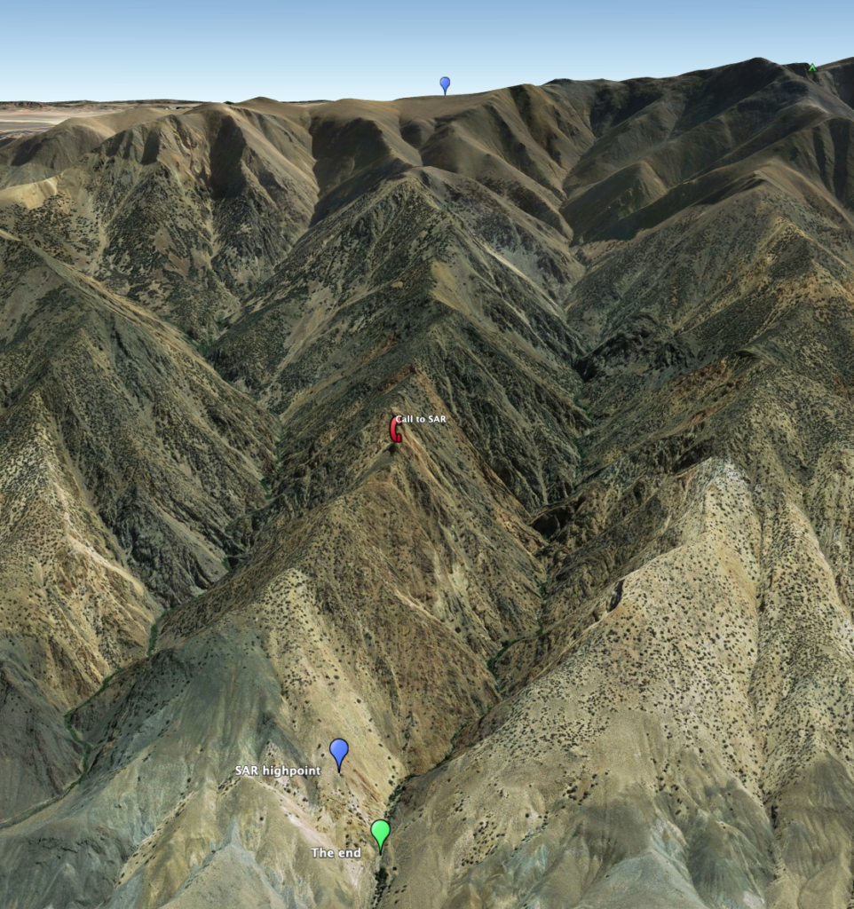
After losing a bit of elevation and climbing behind , things did in fact calm down. The upper ridge was quite straightforward, and even when things became a scramble it was still a joy to be a bit more out of the wind. At 11,000 ft I tried to light my stove to melt snow but it was still too windy. I pressed on down increasingly technical rock to a bit over 9,000 ft. There, I traversed on the north side (steep, snow-covered rock) to bypass four towers. As I approached the final saddle after which it would been a straightforward walk through sagebrush to the valley floor, I stopped in my tracks. Aloud, I said, "If that's my ridge, I need SAR."
I took the photos below on my phone for the sole purpose of aiding search and rescue.


At around 3:30PM and from this viewpoint, I first called Paul, then the White Mountain Ranger District in Bishop (I think the ranger there may have thought I was the somewhat typical exhausted/offroute hiker: "Well, there's no way a helicopter going to get you in this wind.") I responded, "Oh, I'm aware of that! I just need to get a line of communication going so someone can help me with a plan." I was transferred to Inyo County Sheriff and InyoSAR coordinator Victor Lawson. While first determining that I wasn't in Inyo County, and therefore he wouldn't be able to help me (DAMMMIT!) he did stay on the line, pull up my coordinates and start to analyze slopes on CalTopo. He texted me a SARtopo file plotted with a proposed route. Unfortunately, I actually had higher resolution data on my phone, not to mention super high-definition "actual vision" showing that the descent looked like hell at best. He coordinated with Mono County Sheriff and MonoSAR coordinator John Pelichowski. He gave the thumbs up to Victor and my plan, and we coordinated some other details. It was clear that this was really bad and the clock was ticking. We agreed that I would go for it, aiming for a chute they'd identified about 200-300 feet east of me. At first light, a SAR team would start up to search.
The dark art of getting down
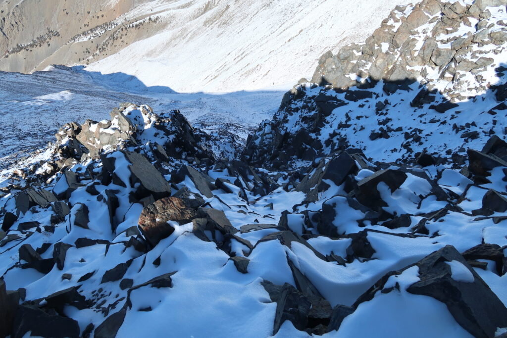
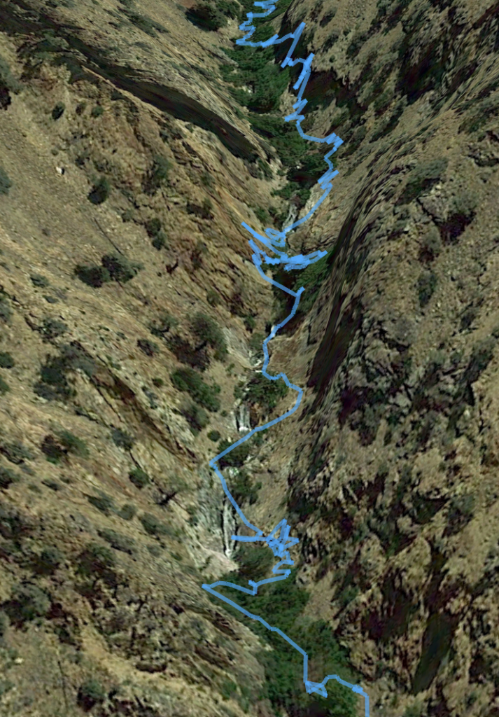
First, I traversed back around the tower, putting the microspikes back on for the sketchy snow. After a time, I reached the saddle between the correct spires and started down the recommended chute. It was an extremely loose, tricky, then sketchy, then scary downclimb. I stopped when the rocks I was slipping on shot over the lip of a 150 foot dry waterfall. To avoid the loose rock, I chose to rock climb the buttress to the right of the chute, which went well into the 5th-class (roped rock climbing). All of the rock, from this point on, was terrible. The worst I've encountered. The largest blocks my feet dislodged were the size of a dinner table. Handholds broke.
I climbed as high as I needed to until I could traverse until the next chute west. An extremely technical rock traverse brought me into the second chute. As with the first chute, it was a horror show. It seemed everything on the face would just get steeper, ending in cliffs. These bands were too small to pick up on the satellite imagery and topo maps, but still far too big to deal with in real life: 30-150 feet. I reascended on another buttress, aiming to explore the next chute but the rock was even more technical. The chutes to my right were near vertical and the buttress was too technical to climb, so I jumped back in the loose chute to slide my way the few hundred feet uphill back to the ridge.
There, Sheriff Pelichowski and I texted. I tried to call Michelle, but almost immediately was called by her parents with confusing questions about Michelle's whereabouts. Her car was stranded in Nevada and the police were worried and looking for her! I then was called by a Santa Clara County Sheriff asking all sorts of rigamaroll about her wellbeing. Once he was sufficiently convinced that she was ok and that I had in fact parked the car in Nevada, he was like, "How are you, by the way?" It's like, dude the only reason I picked up is because I thought this was search and rescue. "Well, I'll let you get back to it then."
I did get through to Michelle as it got pitch black. I strapped on the microspikes, made another long, sketchy snow traverse back up the ridge past two towers to the largest chute. At least this one went the furthest down. Most of it wasn't that bad. I mean, normally I'd consider it horrible. But in this case, I was just thrilled to be moving downward without having to be concerned about dying each move. I made it most of the way down, traversed skiers right across a crappy buttress and dropped into the chute that I believed set me up with the best chance for success. At last, I could hear and see the stream. But I was beyond dismayed that everything in the gorge dropped into a narrow, near-vertical slot canyon. Just 150 feet above the creek, I stood at the lip of a dry waterfall.
By this point, I'd been downclimbing, reascending, and traversing for a few hours in the pitch black. I'd been cautious to eat hardly anything because I needed to focus on hydration. Over 12.5 hours, I consumed a quarter liter of water. The sound of rushing water was torture.
But at least the drainage I was in had a tiny bit of snow in it. I chose to do as I'd done before. I worked my way downstream and systematically work every single option. It's crazy to say this, but it was significantly worse than everything before. The rock was much steeper, and the traversing was outrageously hard. Fear had left me far earlier.
I worked about eight different options, each with their own challenges. One unbelievably hard rock climb up and left was about 250 feet above the black. I ascended extremely technical, poor quality rock, perhaps in the 5.6-5.7 range. Following this final buttress, I saw an easier slope in all directions but unfortunately no descent through the final 30 or so feet to the creek. In an unbelievable moment, I saw a vehicle driving up toward me in the valley! It was Paul. We communicated and ended up telling him to go home as I knew there was no way I'd get out that day.
I communicated again with Sheriff Pelichowski and I told him that I'd head back upstream to the snow and bivy for the night. I ascended high to avoid all of the cliffs and soon reached the landmark dry waterfall. I descended, eager to reach the snow patch only to find that it was just calcite deposits on the rock! From a distance and under headlamp light, I had been tricked. What an unbelievable blow. This was perhaps the lowest moment of the ordeal.
Re-ascend a few thousand feet to actual snow? There, I'd be able to hydrate and communicate. On the other hand, I'd be moving a significant distance in the wrong direction. And by this point, I was more focused on the fact that I had less than 24 hours to get out or I'd be dead. Snow was forecasted to start late afternoon or evening both trapping me and halting rescue efforts.
I made one more hail mary attempt to descend before reascending to the snow. I chose to start with...the waterfall. In a strange sort of luck, the slippery, water-polished stone actually became stickier on the streaky deposits. It felt great. I quickly descended most of the way down the cliff before the final escarpment. Here, I traversed upstream on steeper but better rock. It was clear that this was the only option that would go, as the gorge came to its most impressively vertical at this moment.
It worked. I made it work. It was outrageous, but with the slightly stronger, stickier rock, I was able to make some more gymnastic moves that would have been suicidal on the bad stuff. But make no mistake, it was extreme. It was technical. It was so messed up.
And just like that, I was at the creek on flat-ish ground. I dropped my pack, grabbed my bottle, dunked it in the stream and chugged until brain freeze. And again.


The last day
I quickly found a terrible, but workable platform to pitch my tent. Despite having jagged, microwave-sized blocks, I hastily excavated the boulders, filled in with smaller rocks and pitched my tent. My sleeping pad immediately popped due to the sharp rocks underneath, so I slept on my pack, down jacket and heavy gloves to insulate from the cold. But I was able to eat some great food, down a liter of water and get to bed by 11. After all, SAR was coming up at first light and I wanted to be moving down before dawn to give ourselves the best chance of getting through the canyon.
POP POP BOOM POP!
I instantly threw my arms over my head and braced for impact. An enormous rockfall funneled down the chute and launched over the lip of the waterfall pitch just 50 feet away, exploding on impact and sending debris toward my tent. At this point, I was resigned to the fact that I was trapped in the slot at the base of the 1,700 ft face made up of the loosest rock ready to slide. Still unable to control the situation, I fell back asleep.
I woke up, broke camp, and started down by headlamp an hour before daybreak. The canyon was immediately bushwhacking hell. The worst I've ever experienced even compared to the most choked out Sierran drainages. But it didn't matter. I belly crawled over long thickets of briars, systematically broke willow branches, and every twenty feet, forged a way through the brush to cross the creek on iced-over boulders. But it was okay...I was moving.
The first time my heart sank was when the canyon narrowed to a single slot where the stream plunged over a 100 ft waterfall. Little did I know that half a dozen waterfalls lay below. Unable to do anything but improvise, I repeatedly free soloed up the walls, traversed over awful, loose terrain, and then soloed down to the drainages. Sometimes, it took 40 minutes of sustained rock climbing to cover just 10 feet.

I tracked my forward progress on my phone counting down the feet until the mouth of the canyon. Just 700 feet from safety, I came across a final cliff band. Once again, a couple bighorn sheep tracks led to the base of the right hand cliff, where a 6 inch wide ledge ascended up and around a corner. I delicately climbed the smooth, downward sloping ledge for about 30 feet until I reached a bench, which I traversed along a bighorn trail crossing several loose chutes. At last, I found a tricky but possible talus slope back down to the final cliff. I traversed alluvium beneath the canyon floor, holding on to a tiny bush which broke. But I pulled the final move and reached the floor. After that, a tiny bit of bushwhacking, then wading through 3 foot deep leaves led me to a broad dry wash. Here, I jubilantly messaged SAR to retreat and rendezvous at the cars. I heard the team shout "Hello!" I yelled back, but got no response so I continued down. Once again, I heard "HELLOO!" I spun around and gazed upwards to three figures waving from a small summit above. I screamed and waved back, then waited as I watched them descend. It had taken six hours to cover the final mile. But it was over.
Perspective

Giving Thanks
It's hard to describe the gratitude I have to be here this Thanksgiving. In particular, I am thankful to:
Michelle and my family
Inyo County Sheriff Victor Lawson, Inyo SAR
Mono County Sheriff John Pelichowski
Mono County Search and Rescue. Donate here.
Paul Fretheim, East Side Sierra Shuttle
Max Ferrero and Mint Condition Fitness